Overview
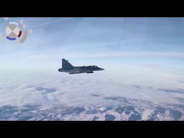
TrackEye Tracking Mount, developed by Image Systems Nordic AB, is an advanced solution for precise tracking and analysis of objects in motion across various distances, including ranges up to 10 kilometers. It is designed to meet the stringent requirements of military test ranges and other high-precision applications, providing detailed 3D position data for comprehensive analysis such as calculating miss distances and object trajectories.
Applications:
- Military Test Ranges: Accurately measures the position and attitude of moving objects such as missiles and targets, facilitating high-precision tests and analyses.
- Research and Development: Provides critical data for the development of new tracking technologies and methodologies, supporting innovation in various fields.
- Aerospace and Defense: Supports rigorous testing and validation of aerospace and defense systems, ensuring performance and reliability.
Highlights
- Video Tracking:
- Invisible wavelengths: IR or hyperspectral cameras
- Visible wavelengths: DVR, high-speed cameras
- Sensors Data Import:
- Radar or range finder integration
- External calibrated parameters and compensations
- Range data files for location, azimuth, elevation, etc.
- System Calibration:
- Mount level calibration
- Internal optical alignment
- Position Calibration:
- Surveyed terrestrial targets
- Sensor validation algorithms for 3D calibrations
- Air Refraction Index Correction:
- Compensates for earth’s curvature and atmospheric refraction
- Ultra-wide Range Tracking:
- Ranges between 500 meters and > 10 kilometers
- Accuracy to about 0.001 degrees
- Image Decoder:
- Decodes IRIG time-stamp for synchronization
- Geodetic Transformations:
- Converts between 3D coordinate systems and GPS data
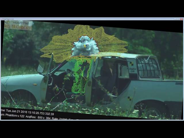
- Background Masking:
- Dynamic background masking/removal
- Projectile Attitude Analysis:
- Measures pitch, yaw, and roll angles
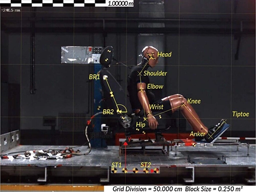
TEMA Classic
- Market-leading motion analysis software
- Sub-pixel accuracy in tracking
- Wide array of tracking algorithms
- Advanced calibration techniques
- Robust 2D and 3D analysis capabilities
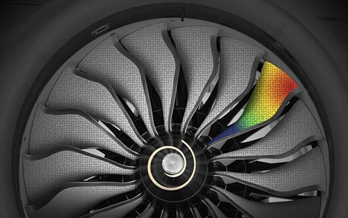
TEMA Pro
- State-of-the-art motion analysis software
- High-speed, accurate data processing
- Extensive tracking algorithm library
- User-friendly interface
- Realistic 3D modeling and analysis